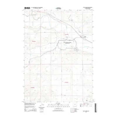
2015 Map of Fort Laramie
USGS Topo · Published 2015About this map
The Fort Laramie National Historic Site dominates this landscape at the confluence of the Laramie River and the North Platte River, preserving the grounds of a pivotal 19th-century military and trading post. Adjacent to the historic grounds, the modern town of Fort Laramie sits near the eastern edge of the quadrangle. The terrain is defined by the broad river valleys and the dissecting drainages of Cottonwood Draw, Sand Draw, and Molly Fork. This modern topographical survey highlights the persistent rural character of Goshen County, showing a network of ranch and county roads such as Road 92 and Co Road 84 that service the surrounding high plains. Water management remains central to the area's geography, visible in features like the Gross Reservoir and the Sandercock Number 3 Reservoir, which support the agricultural life blood of the Wyoming prairie.
Find a feature on this map
31 named features on this map. Tap any name to fly to it.
Don’t see what you’re looking for? This feature index may not catch every label — zoom into the map to look around manually.
Map Details
Editions of this 2015 Fort Laramie Map
This is the sole edition of this map. No revisions or reprints were ever made.
Other maps of this area

1896 · Patrick
USGS Topo · 1:125,000

1896 · Hartville
USGS Topo · 1:125,000

1901 · Hartville
USGS Topo · 1:125,000

1950 · Rockeagle
USGS Topo · 1:24,000

1950 · Guernsey
USGS Topo · 1:24,000

1950 · Casebier Hill
USGS Topo · 1:24,000

1950 · Fort Laramie
USGS Topo · 1:24,000

1950 · Register Cliff
USGS Topo · 1:24,000

1951 · Eagles Nest
USGS Topo · 1:24,000

1952 · Register Cliff
USGS Topo · 1:24,000