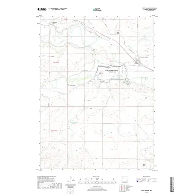
2018 Map of Fort Laramie
USGS Topo · Published 2018About this map
The Fort Laramie National Historic Site anchors this survey of the eastern Wyoming plains, where the North Platte River and Laramie River converge. This landscape reflects a deep layered history of westward migration and military presence, illustrated by the proximity of the town of Fort Laramie to landmark heritage points. Significant commemorative sites are preserved here, including the Mary Homsley Burial Site and the Fort Laramie Cem. The surrounding terrain is defined by dry watercourses such as Cottonwood Draw and Sand Draw, alongside irrigation infrastructure like the Fort Laramie Canal Rd. Further south, the map identifies more isolated points of interest such as Bovee and the Sandercock Number 3 Reservoir, which speak to the rural and agricultural character of Goshen County beyond the central river junction.
Find a feature on this map
45 named features on this map. Tap any name to fly to it.
Don’t see what you’re looking for? This feature index may not catch every label — zoom into the map to look around manually.
Map Details
Editions of this 2018 Fort Laramie Map
This is the sole edition of this map. No revisions or reprints were ever made.
Other maps of this area

1896 · Patrick
USGS Topo · 1:125,000

1896 · Hartville
USGS Topo · 1:125,000

1901 · Hartville
USGS Topo · 1:125,000

1950 · Rockeagle
USGS Topo · 1:24,000

1950 · Guernsey
USGS Topo · 1:24,000

1950 · Casebier Hill
USGS Topo · 1:24,000

1950 · Fort Laramie
USGS Topo · 1:24,000

1950 · Register Cliff
USGS Topo · 1:24,000

1951 · Eagles Nest
USGS Topo · 1:24,000

1952 · Register Cliff
USGS Topo · 1:24,000