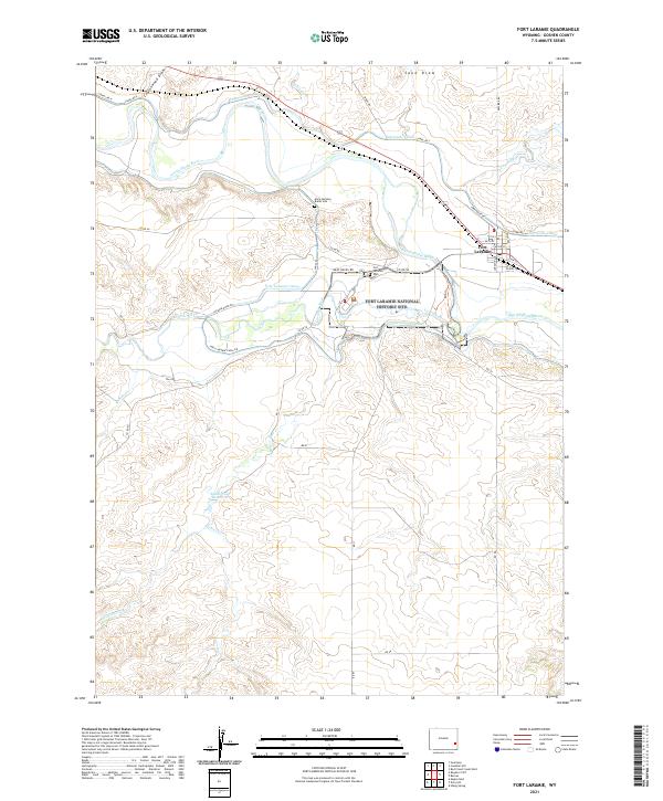
2021 Map of Fort Laramie
USGS Topo · Published 2021About this map
The confluence of the North Platte River and the Laramie River anchors this landscape, where the Fort Laramie National Historic Site preserves the legacy of this vital western outpost. Settlement patterns in the town of Fort Laramie are detailed along streets such as Custer St and Otis St, while the surrounding Goshen County terrain is defined by an extensive irrigation network. The Interstate Canal and Fort Laramie Canal trace the contours of the valley, illustrating the engineering required to sustain agriculture in the high plains. Local history is physically marked on the land at the Mary Homsley Burial Site and the Fort Laramie Cem. To the south and west, the terrain rises into draws like Cottonwood Draw and Sand Draw, punctuated by smaller watercourses such as Sixmile Cr and Deer Cr, which feeds into the Sandercock Reservoir.
Find a feature on this map
42 named features on this map. Tap any name to fly to it.
Don’t see what you’re looking for? This feature index may not catch every label — zoom into the map to look around manually.
Map Details
Editions of this 2021 Fort Laramie Map
This is the sole edition of this map. No revisions or reprints were ever made.
Other maps of this area

1896 · Patrick
USGS Topo · 1:125,000

1896 · Hartville
USGS Topo · 1:125,000

1901 · Hartville
USGS Topo · 1:125,000

1950 · Rockeagle
USGS Topo · 1:24,000

1950 · Guernsey
USGS Topo · 1:24,000

1950 · Casebier Hill
USGS Topo · 1:24,000

1950 · Fort Laramie
USGS Topo · 1:24,000

1950 · Register Cliff
USGS Topo · 1:24,000

1951 · Eagles Nest
USGS Topo · 1:24,000

1952 · Register Cliff
USGS Topo · 1:24,000