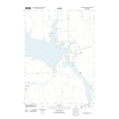
2012 Map of Fort Randall Dam
USGS Topo · Published 2012About this map
Fort Randall Dam dominates this section of the Missouri River, holding back the expansive waters of Lake Francis Case. The infrastructure and road network surrounding the dam reflect the modern management of this critical waterway, with access roads like Spillway Dr and Missouri Dr leading to the Fort Randall Eagle Roost. This landscape is deeply tied to both federal engineering and the area's frontier history, evidenced by the presence of the Old Fort Randall Cem and the nearby Randall Valley Cem.
Find a feature on this map
35 named features on this map. Tap any name to fly to it.
Don’t see what you’re looking for? This feature index may not catch every label — zoom into the map to look around manually.
Map Details
Editions of this 2012 Fort Randall Dam Map
This is the sole edition of this map. No revisions or reprints were ever made.
Other maps of this area

1955 · Mitchell
USGS Topo · 1:250,000

1955 · O'Neill
USGS Topo · 1:250,000

1959 · O'Neill
USGS Topo · 1:250,000

1959 · Mitchell
USGS Topo · 1:250,000

1964 · Ravinia
USGS Topo · 1:24,000

1964 · Lake Andes NW
USGS Topo · 1:24,000

1964 · Fort Randall Dam
USGS Topo · 1:24,000

1964 · Gross
USGS Topo · 1:24,000

1964 · Lake Andes SW
USGS Topo · 1:24,000

1964 · Lake Andes
USGS Topo · 1:24,000