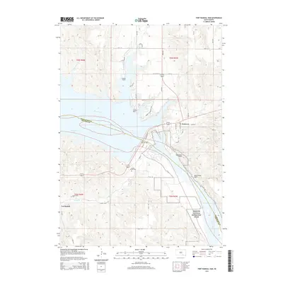
2015 Map of Fort Randall Dam
USGS Topo · Published 2015About this map
Fort Randall Dam stands as the central engineering marvel of this Missouri River landscape, regulating the waters of Lake Francis Case above and the Missouri National Recreation River below. The planned community of Pickstown sits on the bluffs overlooking the spillway, a site originally built to house the workers who constructed the massive dam. This modern topographical survey captures the area's transition from a military and engineering hub to a recreational destination, highlighted by the Prairie Dog Bay Boat Ramp and numerous scenic overlooks like Sunrise Hill.
Find a feature on this map
45 named features on this map. Tap any name to fly to it.
Don’t see what you’re looking for? This feature index may not catch every label — zoom into the map to look around manually.
Map Details
Editions of this 2015 Fort Randall Dam Map
This is the sole edition of this map. No revisions or reprints were ever made.
Other maps of this area

1955 · Mitchell
USGS Topo · 1:250,000

1955 · O'Neill
USGS Topo · 1:250,000

1959 · O'Neill
USGS Topo · 1:250,000

1959 · Mitchell
USGS Topo · 1:250,000

1964 · Ravinia
USGS Topo · 1:24,000

1964 · Lake Andes NW
USGS Topo · 1:24,000

1964 · Fort Randall Dam
USGS Topo · 1:24,000

1964 · Gross
USGS Topo · 1:24,000

1964 · Lake Andes SW
USGS Topo · 1:24,000

1964 · Lake Andes
USGS Topo · 1:24,000