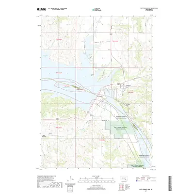
2017 Map of Fort Randall Dam
USGS Topo · Published 2017About this map
Fort Randall Dam serves as the focal point of this landscape, anchoring the massive impoundment of the Missouri River to create Lake Francis Case. The settlement of Pickstown occupies the high ground on the north bank, while the site of Fort Randall lies to the south, preserving the area's frontier military legacy. This modern survey illustrates the juxtaposition of major civil engineering and conservation, with the Karl E Mundt National Wildlife Refuge protecting a significant stretch of the river valley downstream from the dam.
Find a feature on this map
47 named features on this map. Tap any name to fly to it.
Don’t see what you’re looking for? This feature index may not catch every label — zoom into the map to look around manually.
Map Details
Editions of this 2017 Fort Randall Dam Map
This is the sole edition of this map. No revisions or reprints were ever made.
Other maps of this area

1955 · Mitchell
USGS Topo · 1:250,000

1955 · O'Neill
USGS Topo · 1:250,000

1959 · O'Neill
USGS Topo · 1:250,000

1959 · Mitchell
USGS Topo · 1:250,000

1964 · Ravinia
USGS Topo · 1:24,000

1964 · Lake Andes NW
USGS Topo · 1:24,000

1964 · Fort Randall Dam
USGS Topo · 1:24,000

1964 · Gross
USGS Topo · 1:24,000

1964 · Lake Andes SW
USGS Topo · 1:24,000

1964 · Lake Andes
USGS Topo · 1:24,000