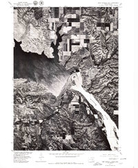
1977 Map of Fort Randall Dam
USGS Topo · Published 1979About this map
Pickstown stands as the primary residential hub overlooking the massive engineering of the Fort Randall Dam in this late 1970s orthophotoquad. This specialized imagery, produced in cooperation with the Bureau of Indian Affairs, provides a unique visual record of the land surface, revealing the intricate network of roads and residential plots in the townsite alongside the stark industrial structures of the dam itself. The survey documents the regulated flow of the Missouri River as it transitions from the wide expanse of Lake Francis Case into the downstream channel. To the southwest, the historic site of Fort Randall is visible, offering a direct link to the region's 19th-century military heritage. The contrast between the geometric patterns of modern agriculture on the bluffs and the deeply eroded coulees leading down to the water's edge illustrates the complex relationship between human development and the river's natural topography.
Find a feature on this map
5 named features on this map. Tap any name to fly to it.
Don’t see what you’re looking for? This feature index may not catch every label — zoom into the map to look around manually.
Map Details
Editions of this 1977 Fort Randall Dam Map
This is the sole edition of this map. No revisions or reprints were ever made.
Other maps of this area

1955 · Mitchell
USGS Topo · 1:250,000

1955 · O'Neill
USGS Topo · 1:250,000

1959 · O'Neill
USGS Topo · 1:250,000

1959 · Mitchell
USGS Topo · 1:250,000

1964 · Ravinia
USGS Topo · 1:24,000

1964 · Lake Andes NW
USGS Topo · 1:24,000

1964 · Fort Randall Dam
USGS Topo · 1:24,000

1964 · Gross
USGS Topo · 1:24,000

1964 · Lake Andes SW
USGS Topo · 1:24,000

1964 · Lake Andes
USGS Topo · 1:24,000