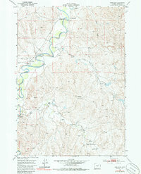
1953 Map of Fort Reno
USGS Topo · Published 1985About this map
The Powder River cuts a winding path through this Wyoming landscape, defining the movement and settlement patterns of Johnson County in the mid-20th century. Historical memory is a central theme of the sheet, which identifies the Bozeman Trail and the site of Fort Reno, a critical outpost during the Indian Wars era. The presence of the Mc Kinney Military Res (Abandoned) further emphasizes the area's legacy as a strategic frontier corridor.
Find a feature on this map
23 named features on this map. Tap any name to fly to it.
Don’t see what you’re looking for? This feature index may not catch every label — zoom into the map to look around manually.
Map Details
Editions of this 1953 Fort Reno Map
3 editions found
Other maps of this area

1953 · Hoe Ranch
USGS Topo · 1:24,000

1953 · Dry Fork Ranch
USGS Topo · 1:24,000

1953 · Fort Reno
USGS Topo · 1:24,000

1953 · Fort Reno SE
USGS Topo · 1:24,000

1953 · The Nipple
USGS Topo · 1:24,000

1954 · House Creek
USGS Topo · 1:24,000

1955 · Arminto
USGS Topo · 1:250,000

1958 · Arminto
USGS Topo · 1:250,000

1961 · Soldier Creek
USGS Topo · 1:24,000

1961 · Provence Ranch
USGS Topo · 1:24,000