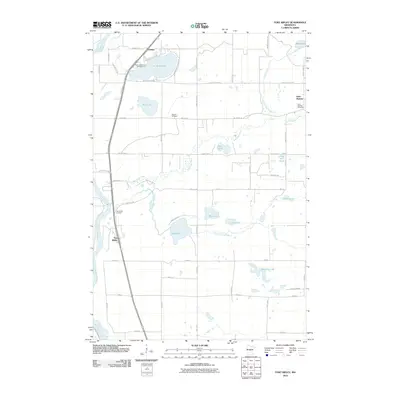
2010 Map of Fort Ripley
USGS Topo · Published 2010About this map
The Mississippi River forms the western boundary of this landscape, where the small settlement of Fort Ripley sits alongside its namesake Fort Ripley Cemetery. Moving inland, the terrain is defined by a dense network of water bodies and marshlands, including Crow Wing Lake and the serpentine paths of the Nokasippi River and Little Nokasippi River. These waterways have long shaped the local geography, influencing the placement of early homesteads and burial grounds like Oak Hill Cemetery and the Saint Mathias Cemetery near the community of Saint Mathias.
Find a feature on this map
57 named features on this map. Tap any name to fly to it.
Don’t see what you’re looking for? This feature index may not catch every label — zoom into the map to look around manually.
Map Details
Editions of this 2010 Fort Ripley Map
This is the sole edition of this map. No revisions or reprints were ever made.
Other maps of this area

1915 · Brainerd
USGS Topo · 1:62,500

1916 · Pillager
USGS Topo · 1:62,500

1918 · Brainerd
USGS Topo · 1:62,500

1919 · Pillager
USGS Topo · 1:62,500

1948 · Belle Prairie
USGS Topo · 1:62,500

1948 · Lastrup
USGS Topo · 1:62,500

1950 · Lastrup
USGS Topo · 1:62,500

1950 · Belle Prairie
USGS Topo · 1:62,500

1953 · Brainerd
USGS Topo · 1:250,000

1954 · Baxter
USGS Topo · 1:24,000