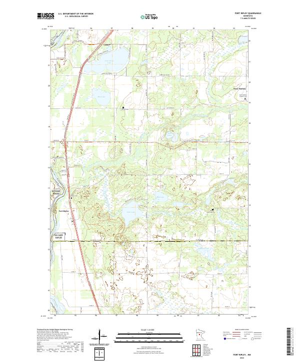
2022 Map of Fort Ripley
USGS Topo · Published 2022About this map
The Mississippi River forms the western boundary of this landscape, where the Nokasippi River and its southern branch, the Little Nokasippi River, wind through a complex system of glacial lakes and wetlands. The small settlements of Fort Ripley and Saint Mathias serve as local anchors, while the historic Fort Ripley Trails Trl and Crow Wing Southern Loop Trl provide modern recreational routes across the undulating terrain. Genealogists and local historians can trace family ties through several dedicated burial grounds, including the Saint Mathias Catholic Cem, Oak Hill Cem, Fort Ripley Cem, and Pine Grove Cem. The map reveals a dense network of water bodies such as Crow Wing Lake, Sebie Lake, and Michaels Lake, which define the drainage patterns of southern Crow Wing County. This 2022 survey captures the modern interface between established rural townships and the natural waterways that have shaped the region since its early settlement.
Find a feature on this map
78 named features on this map. Tap any name to fly to it.
Don’t see what you’re looking for? This feature index may not catch every label — zoom into the map to look around manually.
Map Details
Editions of this 2022 Fort Ripley Map
This is the sole edition of this map. No revisions or reprints were ever made.
Other maps of this area

1915 · Brainerd
USGS Topo · 1:62,500

1916 · Pillager
USGS Topo · 1:62,500

1918 · Brainerd
USGS Topo · 1:62,500

1919 · Pillager
USGS Topo · 1:62,500

1948 · Belle Prairie
USGS Topo · 1:62,500

1948 · Lastrup
USGS Topo · 1:62,500

1950 · Lastrup
USGS Topo · 1:62,500

1950 · Belle Prairie
USGS Topo · 1:62,500

1953 · Brainerd
USGS Topo · 1:250,000

1954 · Baxter
USGS Topo · 1:24,000