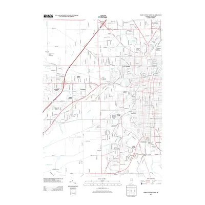
2013 Map of Fort Wayne West
USGS Topo · Published 2013About this map
The Saint Marys River winds through the southwestern reaches of Fort Wayne, defining a landscape of established neighborhoods and specialized water management. Subdivisions such as Indian Village, Waynedale, and Covington Dells characterize the suburban expansion west of the city center. The terrain is marked by an extensive network of drainage features, including the Junk Ditch, Fairfield Ditch, and Graham McCulloch Ditch, which channel water toward the primary river corridor. Small aviation facilities like Dick's Strip Airport and Confer's Place Airport sit on the western periphery, reflecting the localized transit infrastructure of the early 21st century. Recreational spaces and natural landmarks are anchored by Foster Park and Shoaff Lake, while the Stellhorn Bridge provides a notable crossing point for local history researchers and genealogists tracing the development of Avalon and Lincolnshire.
Find a feature on this map
163 named features on this map. Tap any name to fly to it.
Don’t see what you’re looking for? This feature index may not catch every label — zoom into the map to look around manually.
Map Details
Editions of this 2013 Fort Wayne West Map
This is the sole edition of this map. No revisions or reprints were ever made.
Other maps of this area

1953 · Fort Wayne
USGS Topo · 1:250,000

1953 · Muncie
USGS Topo · 1:250,000

1956 · Muncie
USGS Topo · 1:250,000

1956 · Fort Wayne
USGS Topo · 1:250,000

1956 · Fort Wayne West
USGS Topo · 1:24,000

1956 · Fort Wayne East
USGS Topo · 1:24,000

1956 · Cedarville
USGS Topo · 1:24,000

1957 · Huntertown
USGS Topo · 1:24,000

1957 · Churubusco
USGS Topo · 1:24,000

1961 · Arcola
USGS Topo · 1:24,000
Featured Places
- Fort Wayne, IN
- Ansley Acres, IN
- Covington Dells, Fort Wayne
- Indian Village, Fort Wayne
- Lake Shores, Fort Wayne