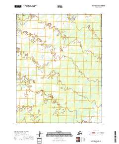
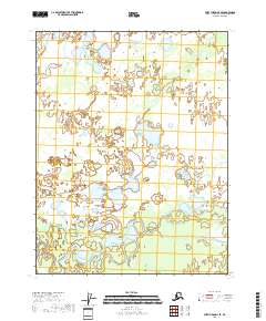
2018 Map of Fort Yukon D-2 NW
USGS Topo · Published 2018About this map
The vast interior of the T25n R13e and T24n R13e townships reveals a landscape defined by an intricate network of waterways and wetlands typical of the Yukon River watershed. Produced by the U.S. Geological Survey, this 2018 survey documents a region where human infrastructure is largely absent, replaced by the natural shifts of braided river channels and standing water. The map's layout, which also covers portions of T25n R12e, T25n R14e, and T24n R14e, is primarily a record of hydrology and topography for environmental and mapping professionals rather than a record of permanent settlement. For those studying the hydrology of the Yukon-Koyukuk region, the precise delineation of the National Hydrography Dataset here provides an important baseline for understanding how these remote northern wetlands evolve over time.
Find a feature on this map
5 named features on this map. Tap any name to fly to it.
Don’t see what you’re looking for? This feature index may not catch every label — zoom into the map to look around manually.
Map Details
Editions of this 2018 Fort Yukon D-2 NW Map
This is the sole edition of this map. No revisions or reprints were ever made.
Other maps of this area

1951 · Fort Yukon
USGS Topo · 1:250,000

1951 · Christian
USGS Topo · 1:250,000

1955 · Fort Yukon D-2
USGS Topo · 1:63,360

1955 · Fort Yukon D-3
USGS Topo · 1:63,360

1956 · Christian
USGS Topo · 1:250,000

1956 · Fort Yukon
USGS Topo · 1:250,000
1956 · Fort Yukon D-3
USGS Topo · 1:63,360
1990 · Christian A-3
USGS Topo · 1:63,360
1990 · Christian A-2
USGS Topo · 1:63,360
2018 · Fort Yukon D-3 SE
USGS Topo · 1:25,000