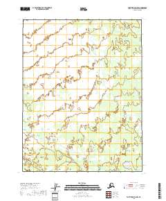
2018 Map of Fort Yukon D-6 NW
USGS Topo · Published 2018About this map
The low-lying interior of the Yukon-Koyukuk Census Area is captured here as a sprawling network of wetlands and seasonal water bodies. This 2018 survey reveals a landscape almost entirely defined by its hydrography, where nameless lakes and meandering channels dominate the terrain. The area is structured by the Public Land Survey System, with boundaries clearly delineated for townships including t25n r4e and t24n r4e. The absence of named settlements, roads, or localized landmarks reflects the extreme isolation of this portion of the Fort Yukon quadrangle.
Find a feature on this map
6 named features on this map. Tap any name to fly to it.
Don’t see what you’re looking for? This feature index may not catch every label — zoom into the map to look around manually.
Map Details
Editions of this 2018 Fort Yukon D-6 NW Map
This is the sole edition of this map. No revisions or reprints were ever made.
Other maps of this area

1951 · Fort Yukon
USGS Topo · 1:250,000

1951 · Chandalar
USGS Topo · 1:250,000

1951 · Christian
USGS Topo · 1:250,000

1951 · Beaver
USGS Topo · 1:250,000

1956 · Chandalar
USGS Topo · 1:250,000

1956 · Beaver
USGS Topo · 1:250,000

1956 · Christian
USGS Topo · 1:250,000

1956 · Fort Yukon
USGS Topo · 1:250,000
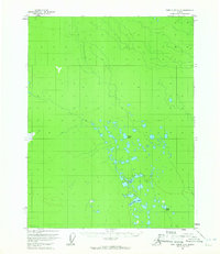
1956 · Fort Yukon D-6
USGS Topo · 1:63,360

1964 · Chandalar
USGS Topo · 1:250,000