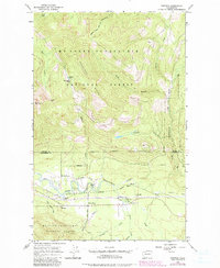
1966 Map of Fortson
USGS Topo · Published 1982About this map
Fortson and White Horse sit within the river-cut valley of the North Fork Stillaguamish River, where local industry and transportation defined the mid-century landscape. The Northern Pacific railroad tracks run parallel to the river, serving small settlements and connecting them to the larger regional economy. To the north, the terrain rises sharply toward Segelsen Ridge and Round Mountain, marking the transition into the protected lands of the Mt Baker-Snoqualmie National Forest.
Find a feature on this map
34 named features on this map. Tap any name to fly to it.
Don’t see what you’re looking for? This feature index may not catch every label — zoom into the map to look around manually.
Map Details
Editions of this 1966 Fortson Map
3 editions found
Other maps of this area

1899 · Stillaguamish
USGS Topo · 1:125,000

1901 · Stilaguamish
USGS Topo · 1:125,000

1955 · Concrete
USGS Topo · 1:250,000

1956 · Oso
USGS Topo · 1:62,500

1956 · Granite Falls
USGS Topo · 1:62,500

1957 · Silverton
USGS Topo · 1:62,500

1958 · Concrete
USGS Topo · 1:250,000

1962 · Concrete
USGS Topo · 1:250,000
1966 · Darrington
USGS Topo · 1:24,000
1966 · Fortson
USGS Topo · 1:24,000