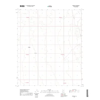
2018 Map of Fortuna SW
USGS Topo · Published 2018About this map
The Yuma Desert landscape dominates this modern survey, revealing an arid expanse within the Yuma city limits defined by ephemeral drainage patterns and historical thoroughfares. The terrain is marked by the presence of Fortuna Wash, which cuts through the northeastern corner of the quadrangle, illustrating the natural hydrological features that dictate movement in this desert environment. Notable road networks include Ave 13E and the evocative Cam Del Diablo, a name that suggests the difficult travel historically associated with these desert paths. This topographic study documents the section lines and township boundaries of the Public Land Survey System, including t10s r22w and t10s r21w, providing a clear structural framework for understanding modern land management and historical parceling in this corner of Arizona.
Find a feature on this map
11 named features on this map. Tap any name to fly to it.
Don’t see what you’re looking for? This feature index may not catch every label — zoom into the map to look around manually.
Map Details
Editions of this 2018 Fortuna SW Map
This is the sole edition of this map. No revisions or reprints were ever made.
Other maps of this area

1903 · Yuma
USGS Topo · 1:125,000

1905 · Yuma
USGS Topo · 1:125,000

1926 · Fortuna
USGS Topo · 1:62,500

1929 · Fortuna
USGS Topo · 1:62,500

1940 · Yuma
USGS Topo · 1:62,500

1942 · Yuma
USGS Topo · 1:250,000

1945 · Yuma
USGS Topo · 1:62,500

1952 · Yuma East
USGS Topo · 1:24,000

1954 · El Centro
USGS Topo · 1:250,000

1955 · El Centro
USGS Topo · 1:250,000