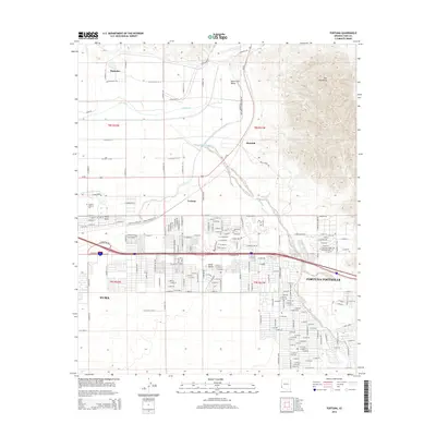
2014 Map of Fortuna
USGS Topo · Published 2014About this map
The Gila River meanders through the northern section of this landscape, supporting agricultural activity in the South Gila Valley before the terrain rises sharply into the Gila Mountains. This area east of Yuma illustrates the transition from river-bottom cultivation, managed by the S Gila Valley Main Canal, to the suburban expansion of Fortuna Foothills. The 2014 survey captures a distinct mix of established desert settlements like Fortuna and Blaisdell alongside contemporary residential development and educational facilities such as Arizona Western Coll. A significant presence of seasonal communities is visible through numerous named parks, including the Desert Parao RV Resort and Sands RV Park, reflecting the region's importance as a winter destination. The map also traces the drainage of the Fortuna Wash as it cuts through the developing grid of the Yuma Desert.
Find a feature on this map
120 named features on this map. Tap any name to fly to it.
Don’t see what you’re looking for? This feature index may not catch every label — zoom into the map to look around manually.
Map Details
Editions of this 2014 Fortuna Map
This is the sole edition of this map. No revisions or reprints were ever made.
Other maps of this area

1903 · Yuma
USGS Topo · 1:125,000

1905 · Yuma
USGS Topo · 1:125,000

1926 · Fortuna
USGS Topo · 1:62,500

1929 · Fortuna
USGS Topo · 1:62,500

1929 · Laguna
USGS Topo · 1:62,500

1940 · Yuma
USGS Topo · 1:62,500

1942 · Yuma
USGS Topo · 1:250,000

1943 · Laguna
USGS Topo · 1:62,500

1945 · Picacho Peak
USGS Topo · 1:62,500

1945 · Yuma
USGS Topo · 1:62,500