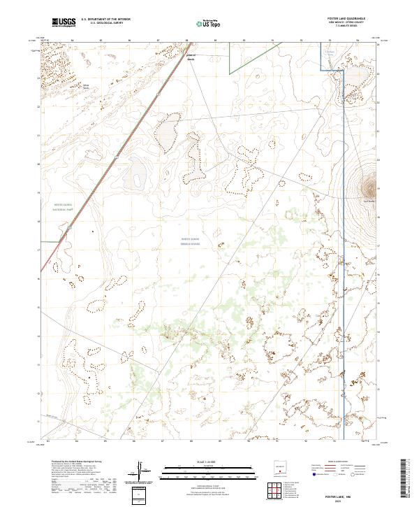
2023 Map of Foster Lake
USGS Topo · Published 2023About this map
White Sands National Park and the adjacent White Sands Missile Range dominate this desert landscape in Otero County, where modern military operations and conservation efforts meet. The terrain is defined by the stark gypsum formations of White Sands and prominent landmarks like Point of Sands and Twin Buttes. Human presence is largely restricted to specific infrastructure, notably Highway 70 cutting through the western section and specialized routes such as Wsmr S RT 260. While most of the quadrangle is arid and open, the presence of Harrington Spring in the northeast indicates a rare reliable water source. The map provides a detailed view of the Public Land Survey System boundaries, including t18s r7e and t19s r8e, which organize this vast, controlled environment.
Find a feature on this map
13 named features on this map. Tap any name to fly to it.
Don’t see what you’re looking for? This feature index may not catch every label — zoom into the map to look around manually.
Map Details
Editions of this 2023 Foster Lake Map
This is the sole edition of this map. No revisions or reprints were ever made.
Other maps of this area

1916 · Point Of Sands
USGS Topo · 1:125,000

1947 · Point Of Sands 2
USGS Topo · 1:62,500

1947 · Lake Lucero
USGS Topo · 1:62,500

1948 · Tres Hermanos
USGS Topo · 1:62,500

1948 · Holloman
USGS Topo · 1:62,500

1948 · Lake Lucero SE
USGS Topo · 1:24,000
1950 · Lake Lucero SE
USGS Topo · 1:24,000
1950 · Lake Lucero NE
USGS Topo · 1:24,000

1955 · Las Cruces
USGS Topo · 1:250,000

1958 · Las Cruces
USGS Topo · 1:250,000