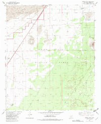
1982 Map of Foster Lake
USGS Topo · Published 1982About this map
White Sands National Monument dominates the northern landscape of this 1982 survey, defined by the stark White Sands and areas of shifting sand. This high desert environment in Otero County is largely occupied by the White Sands Missile Range, illustrating the intersection of federal conservation and military testing grounds during the late twentieth century.
Find a feature on this map
16 named features on this map. Tap any name to fly to it.
Don’t see what you’re looking for? This feature index may not catch every label — zoom into the map to look around manually.
Map Details
Editions of this 1982 Foster Lake Map
This is the sole edition of this map. No revisions or reprints were ever made.
Other maps of this area

1916 · Point Of Sands
USGS Topo · 1:125,000

1947 · Point Of Sands 2
USGS Topo · 1:62,500

1947 · Lake Lucero
USGS Topo · 1:62,500

1948 · Tres Hermanos
USGS Topo · 1:62,500

1948 · Holloman
USGS Topo · 1:62,500

1948 · Lake Lucero SE
USGS Topo · 1:24,000
1950 · Lake Lucero SE
USGS Topo · 1:24,000
1950 · Lake Lucero NE
USGS Topo · 1:24,000

1955 · Las Cruces
USGS Topo · 1:250,000

1958 · Las Cruces
USGS Topo · 1:250,000