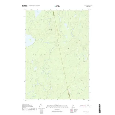
2018 Map of Foster Ridge
USGS Topo · Published 2018About this map
The Somerset and Piscataquis county line bisects this landscape of interconnected wetlands and upland divides. Central to the topography is Foster Ridge, which stands between the sprawling waters of Bald Mountain Pond to the north and the complex drainage of the South Branch Austin Stream to the south. The area is defined by a heavy concentration of bogs and flowages, including Kingsley Bog, Nye Bog, and Baker Flowage, suggesting a low-lying, water-saturated environment punctuated by steep ridges like Crockett Ridge.
Find a feature on this map
40 named features on this map. Tap any name to fly to it.
Don’t see what you’re looking for? This feature index may not catch every label — zoom into the map to look around manually.
Map Details
Editions of this 2018 Foster Ridge Map
This is the sole edition of this map. No revisions or reprints were ever made.
Other maps of this area

1903 · Bingham
USGS Topo · 1:62,500

1905 · Bingham
USGS Topo · 1:62,500

1905 · The Forks
USGS Topo · 1:62,500

1907 · The Forks
USGS Topo · 1:62,500

1948 · Kingsbury
USGS Topo · 1:62,500

1950 · Kingsbury
USGS Topo · 1:62,500

1951 · Greenville
USGS Topo · 1:62,500

1954 · Millinocket
USGS Topo · 1:250,000

1956 · The Forks
USGS Topo · 1:62,500

1956 · Bingham
USGS Topo · 1:62,500
Featured Places
- Blanchard Township, ME
- Kingsbury Plantation, ME
- Mayfield Township, ME
- Bald Mountain Township, ME
- Somerset County, ME