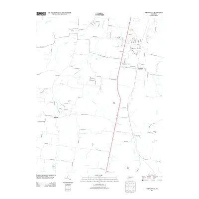
2013 Map of Fosterville
USGS Topo · Published 2013About this map
The W Fork Stones River and its numerous tributaries, including Panther Cr and Dry Fork Cr, carve through this section of Rutherford County. Small communities and residential developments like Christiana, Fosterville, and Steeplechase Meadows are scattered across the landscape, connected by a dense network of local roads such as Armstrong Valley Rd and Steeplechase Rd. Natural landmarks like Johns Spring and Holden Spring indicate a landscape historically tied to local water sources, while the presence of Long Meadow Airstrip suggests modern regional utility. Elevated terrain is marked by distinctive features such as Nebo Knobs, Hickory Hill, and Soapstone Hill, which provide a vertical contrast to the river valleys. The map documents a transition from traditional rural settlements like Midland to newer subdivisions like Elils Ranch Acres, illustrating the evolving residential patterns of the early 21st century.
Find a feature on this map
114 named features on this map. Tap any name to fly to it.
Don’t see what you’re looking for? This feature index may not catch every label — zoom into the map to look around manually.
Map Details
Editions of this 2013 Fosterville Map
This is the sole edition of this map. No revisions or reprints were ever made.
Other maps of this area

1916 · Murfreesboro
USGS Topo · 1:62,500

1936 · Webbs Jungle
USGS Topo · 1:24,000

1936 · Rover
USGS Topo · 1:24,000

1936 · Deason
USGS Topo · 1:24,000

1936 · Wartrace
USGS Topo · 1:24,000

1936 · Unionville
USGS Topo · 1:24,000

1936 · Fosterville
USGS Topo · 1:24,000

1942 · Lebanon
USGS Topo · 1:100,000

1944 · Shelbyville
USGS Topo · 1:100,000
1947 · Unionville
USGS Topo · 1:24,000