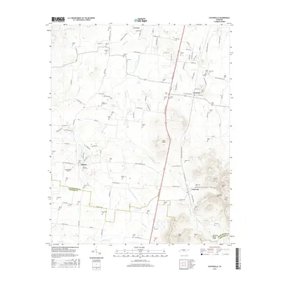
2016 Map of Fosterville
USGS Topo · Published 2016About this map
Fosterville and Christiana anchor this 2016 survey of the Tennessee landscape where Rutherford and Bedford Counties meet. The terrain is defined by the Tennessee Valley Divide and the winding course of the West Fork Stones River, which carves through a region characterized by small rural settlements and family-named landmarks. The map is exceptionally rich for genealogical research, documenting dozens of burial sites such as the Isaac Miller Cem, Smotherman Cem, and Williams-McLain Cem, many associated with early homesteads.
Find a feature on this map
131 named features on this map. Tap any name to fly to it.
Don’t see what you’re looking for? This feature index may not catch every label — zoom into the map to look around manually.
Map Details
Editions of this 2016 Fosterville Map
This is the sole edition of this map. No revisions or reprints were ever made.
Other maps of this area

1916 · Murfreesboro
USGS Topo · 1:62,500

1936 · Webbs Jungle
USGS Topo · 1:24,000

1936 · Rover
USGS Topo · 1:24,000

1936 · Deason
USGS Topo · 1:24,000

1936 · Wartrace
USGS Topo · 1:24,000

1936 · Unionville
USGS Topo · 1:24,000

1936 · Fosterville
USGS Topo · 1:24,000

1942 · Lebanon
USGS Topo · 1:100,000

1944 · Shelbyville
USGS Topo · 1:100,000
1947 · Unionville
USGS Topo · 1:24,000