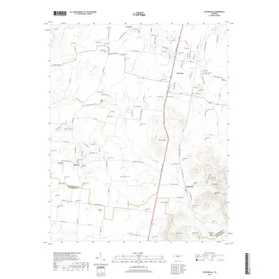
2019 Map of Fosterville
USGS Topo · Published 2019About this map
Christiana and Fosterville anchor this landscape along the Shelbyville Pike, where the rolling terrain of Middle Tennessee transitions toward the Tennessee Valley Divide. The map reveals a dense concentration of family-named landmarks and cemeteries, such as the Blankenship Cem and Isaac Miller Cem, reflecting generations of settlement in Rutherford and Bedford counties. The West Fork of the Stones River and various smaller tributaries like Armstrong Br and Panther Cr provide the primary drainage for the area.
Find a feature on this map
137 named features on this map. Tap any name to fly to it.
Don’t see what you’re looking for? This feature index may not catch every label — zoom into the map to look around manually.
Map Details
Editions of this 2019 Fosterville Map
This is the sole edition of this map. No revisions or reprints were ever made.
Other maps of this area

1916 · Murfreesboro
USGS Topo · 1:62,500

1936 · Webbs Jungle
USGS Topo · 1:24,000

1936 · Rover
USGS Topo · 1:24,000

1936 · Deason
USGS Topo · 1:24,000

1936 · Wartrace
USGS Topo · 1:24,000

1936 · Unionville
USGS Topo · 1:24,000

1936 · Fosterville
USGS Topo · 1:24,000

1942 · Lebanon
USGS Topo · 1:100,000

1944 · Shelbyville
USGS Topo · 1:100,000
1947 · Unionville
USGS Topo · 1:24,000