
1936 Map of Fosterville
USGS Topo · Published 1936About this map
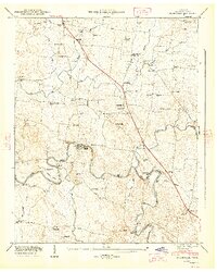
Tennessee Divide cuts across this mid-1930s landscape, marking the topographic boundary between the northern Basin and the southern drainage of North Fork Creek. This advance sheet, compiled from early aerial photography by the Tennessee Valley Authority and USGS, captures a rural intersection of education and infrastructure on the Rutherford and Bedford county line. Local landmarks like Keyes Chapel Sch and Guy Gap Sch serve as community anchors, while the Woodfin Cem reflects the deep-rooted family history of the area. The map illustrates the era's primary transport arteries, including U S Highway No 241 and the N C & St L railroad, which facilitated the movement of goods and people across the divide during the Depression years.
Find a feature on this map
14 named features on this map. Tap any name to fly to it.
Don’t see what you’re looking for? This feature index may not catch every label — zoom into the map to look around manually.
Map Details
Editions of this 1936 Fosterville Map
This is the sole edition of this map. No revisions or reprints were ever made.
Other maps of this area

1916 · Murfreesboro
USGS Topo · 1:62,500

1936 · Webbs Jungle
USGS Topo · 1:24,000

1936 · Rover
USGS Topo · 1:24,000

1936 · Deason
USGS Topo · 1:24,000

1936 · Wartrace
USGS Topo · 1:24,000

1936 · Unionville
USGS Topo · 1:24,000

1942 · Lebanon
USGS Topo · 1:100,000

1944 · Shelbyville
USGS Topo · 1:100,000
1947 · Unionville
USGS Topo · 1:24,000
1949 · Rover
USGS Topo · 1:24,000