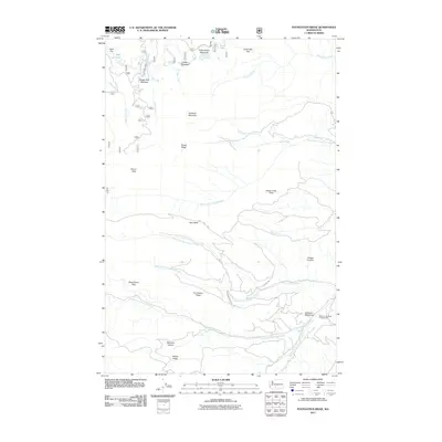
2011 Map of Foundation Ridge
USGS Topo · Published 2011About this map
Strobach Mountain and Divide Ridge dominate this high-altitude landscape in Yakima County, where a complex network of creeks drains the eastern slopes of the Cascades. The map reveals a wilderness shaped by water and high meadows, with North Fork Foundation Creek and South Fork Foundation Creek converging near the prominent Foundation Ridge. Recreational and seasonal use is evident through features like the Ahtanum Meadow Campground and the presence of Lost Lake Rd. The terrain is characterized by numerous alpine openings such as Sleepy Park Meadow, Golden Meadow, and the interestingly named Dead Horse Flats. To the north, Fish Lake and Long Lake sit near the headwaters of Fish Creek and Milk Creek, while landmarks like Dome Peak and Ewe Neck provide significant navigational points for those traversing this remote region.
Find a feature on this map
34 named features on this map. Tap any name to fly to it.
Don’t see what you’re looking for? This feature index may not catch every label — zoom into the map to look around manually.
Map Details
Editions of this 2011 Foundation Ridge Map
This is the sole edition of this map. No revisions or reprints were ever made.
Other maps of this area

1899 · Ellensburg
USGS Topo · 1:125,000

1901 · Ellensburg
USGS Topo · 1:125,000

1902 · Mount Aix
USGS Topo · 1:125,000

1904 · Mt Aix
USGS Topo · 1:125,000

1904 · Mount Adams
USGS Topo · 1:125,000

1907 · Mount Adams
USGS Topo · 1:125,000

1937 · White Swan
USGS Topo · 1:125,000

1950 · Yakima
USGS Topo · 1:250,000

1957 · Yesmowit Canyon
USGS Topo · 1:24,000

1958 · Fort Simcoe
USGS Topo · 1:62,500