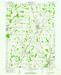
1960 Map of Fountain City
USGS Topo · Published 1961About this map
Fountain City and the neighboring agricultural settlements of Williamsburg, Webster, and Chester anchor this 1960 landscape in northern Wayne County. The area is defined by a dense network of watercourses, including the Greens Fork, Nolands Fork, and the Whitewater River, which dictated the early layout of regional roads and rails. Two major rail lines, the Pennsylvania and the Chesapeake and Ohio, intersect the terrain, providing a look at the infrastructure of mid-century Indiana commerce. Local history is deeply embedded in the rural landscape, marked by numerous pioneer-era burial grounds such as Old Concord Cem, Willow Grove Cem, and Dover Cem. A Covered Bridge on Quill Cr south of Fountain City serves as a tangible link to 19th-century construction methods that persisted into the modern era.
Find a feature on this map
66 named features on this map. Tap any name to fly to it.
Don’t see what you’re looking for? This feature index may not catch every label — zoom into the map to look around manually.
Map Details
Editions of this 1960 Fountain City Map
This is the sole edition of this map. No revisions or reprints were ever made.
Other maps of this area

1915 · New Paris
USGS Topo · 1:48,000

1916 · Winchester
USGS Topo · 1:48,000

1918 · Winchester
USGS Topo · 1:62,500

1918 · New Paris
USGS Topo · 1:62,500

1943 · Winchester
USGS Topo · 1:62,500

1953 · Cincinnati
USGS Topo · 1:250,000

1953 · Muncie
USGS Topo · 1:250,000

1956 · Muncie
USGS Topo · 1:250,000

1957 · Cincinnati
USGS Topo · 1:250,000

1960 · Carlos
USGS Topo · 1:24,000