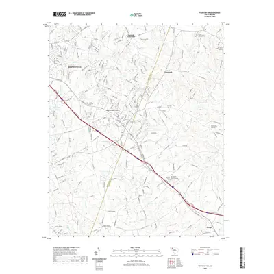
2020 Map of Fountain Inn
USGS Topo · Published 2020About this map
Fountain Inn sits at the heart of this landscape, straddling the line between Greenville and Laurens counties. The area is defined by its small crossroads communities and a high concentration of established rural religious centers. Communities like Gaylords Crossroads and Cooks Crossroads punctuate the rolling terrain, while the settlement of Owings anchors the southeastern corner. The map reveals a deep-rooted social fabric through its numerous memorial sites, including the Fountain Inn Municipal Cem and several older church-affiliated burial grounds. Waterways such as Durbin Cr and S Rabon Cr wind through the countryside, often accompanied by family-named landmarks like Jays Lake and Thads Pond. To the northwest, the expansion of Simpsonville is evident, showing the transition from traditional rural South Carolina farmland to a more modern residential and industrial network.
Find a feature on this map
230 named features on this map. Tap any name to fly to it.
Don’t see what you’re looking for? This feature index may not catch every label — zoom into the map to look around manually.
Map Details
Editions of this 2020 Fountain Inn Map
This is the sole edition of this map. No revisions or reprints were ever made.
Other maps of this area

1935 · Greer
USGS Topo · 1:48,000

1935 · Greenville
USGS Topo · 1:48,000

1938 · Greenville
USGS Topo · 1:62,500

1938 · Greer
USGS Topo · 1:62,500

1954 · Greenville
USGS Topo · 1:250,000

1957 · Fountain Inn
USGS Topo · 1:62,500

1957 · Williamston
USGS Topo · 1:62,500

1957 · Greer
USGS Topo · 1:62,500

1957 · Greenville
USGS Topo · 1:62,500

1958 · Greenville
USGS Topo · 1:250,000