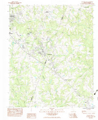
1983 Map of Fountain Inn
USGS Topo · Published 1983About this map
Fountain Inn and Simpsonville anchor this 1983 provisional survey of the Upstate, showing the area's development along the Seaboard rail line. The landscape is characterized by its transition from agricultural crossroads to suburban growth, with the border between Greenville Co and Laurens Co cutting through the southern half of the map. Local history is preserved through numerous rural congregations and landmarks, such as Old Shady Oak Ch, Bethlehem Ch, and Pine Grove Ch, which remain key community focal points.
Find a feature on this map
33 named features on this map. Tap any name to fly to it.
Don’t see what you’re looking for? This feature index may not catch every label — zoom into the map to look around manually.
Map Details
Editions of this 1983 Fountain Inn Map
This is the sole edition of this map. No revisions or reprints were ever made.
Other maps of this area

1935 · Greer
USGS Topo · 1:48,000

1935 · Greenville
USGS Topo · 1:48,000

1938 · Greenville
USGS Topo · 1:62,500

1938 · Greer
USGS Topo · 1:62,500

1954 · Greenville
USGS Topo · 1:250,000

1957 · Fountain Inn
USGS Topo · 1:62,500

1957 · Williamston
USGS Topo · 1:62,500

1957 · Greer
USGS Topo · 1:62,500

1957 · Greenville
USGS Topo · 1:62,500

1958 · Greenville
USGS Topo · 1:250,000