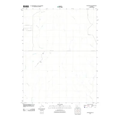
2010 Map of Fountain NE
USGS Topo · Published 2010About this map
Williams Creek and Chico Creek define the drainage patterns of this high plains landscape east of the Front Range. The area is characterized by low-density ranching and rural residential development, with the Kane Ranch serving as a primary landmark in the central portion of the quadrangle. Transport and access are facilitated by a grid of rural routes including S Squirrel Creek Rd and Peaceful Valley Rd, which cross the sparse prairie terrain. A specific point of local interest for researchers is the Bailey Windmill, a functional piece of agricultural infrastructure situated near Kane Rd. This 2010 survey reflects a period of modern land management in El Paso County, where traditional livestock operations and newer residential roads like Green Spring Rd and Thunderhead Dr coexist on the open range.
Find a feature on this map
10 named features on this map. Tap any name to fly to it.
Don’t see what you’re looking for? This feature index may not catch every label — zoom into the map to look around manually.
Map Details
Editions of this 2010 Fountain NE Map
This is the sole edition of this map. No revisions or reprints were ever made.
Other maps of this area

1893 · Big Springs
USGS Topo · 1:125,000

1893 · Colorado Springs
USGS Topo · 1:125,000

1909 · Colorado Springs
USGS Topo · 1:125,000

1942 · Colorado Springs
USGS Topo · 1:125,000

1948 · Fountain SE
USGS Topo · 1:24,000

1948 · Fountain
USGS Topo · 1:24,000

1948 · Falcon
USGS Topo · 1:62,500
1949 · Buttes
USGS Topo · 1:24,000

1949 · Corral Bluffs
USGS Topo · 1:24,000
1950 · Elsmere
USGS Topo · 1:24,000