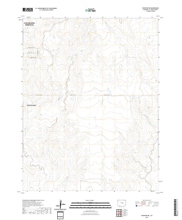
2022 Map of Fountain NE
USGS Topo · Published 2022About this map
The rolling plains of El Paso County south of Colorado Springs define this modern survey of the high desert landscape. The terrain is shaped by the drainage patterns of Williams Creek and Chico Cr, which carve subtle arroyos through the township sections. Small-scale development and rural road networks are centered around the northeastern edge of Fountain, where residential streets like Raintree Dr meet established thoroughfares like Squirrel Creek Rd. The map illustrates a rural-to-suburban transition, with named routes such as Peaceful Valley Rd and Green Spring RD cutting across the survey lines. This 2022 edition provides a precise look at the modern topography and property boundaries within T15S and T16S, reflecting the ongoing expansion in the Front Range corridor.
Find a feature on this map
15 named features on this map. Tap any name to fly to it.
Don’t see what you’re looking for? This feature index may not catch every label — zoom into the map to look around manually.
Map Details
Editions of this 2022 Fountain NE Map
This is the sole edition of this map. No revisions or reprints were ever made.
Other maps of this area

1893 · Big Springs
USGS Topo · 1:125,000

1893 · Colorado Springs
USGS Topo · 1:125,000

1909 · Colorado Springs
USGS Topo · 1:125,000

1942 · Colorado Springs
USGS Topo · 1:125,000

1948 · Fountain SE
USGS Topo · 1:24,000

1948 · Fountain
USGS Topo · 1:24,000

1948 · Falcon
USGS Topo · 1:62,500
1949 · Buttes
USGS Topo · 1:24,000

1949 · Corral Bluffs
USGS Topo · 1:24,000
1950 · Elsmere
USGS Topo · 1:24,000