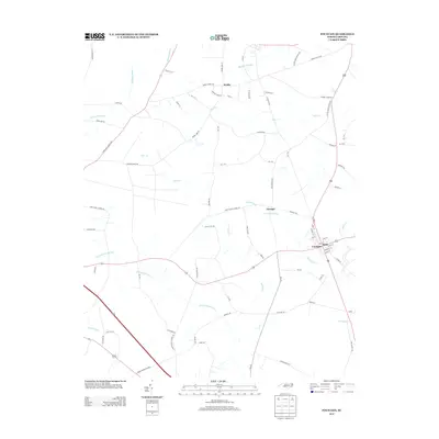
2013 Map of Fountain
USGS Topo · Published 2013About this map
Fountain stands as the primary hub in this eastern North Carolina landscape, where the confluence of regional roads and small-scale agriculture defines the local geography. The area is characterized by an intricate network of slow-moving water systems, including Little Contentnea Creek, Langs Mill Run, and Bynums Mill Run, which drain the surrounding wetlands like Whiteoak Swamp and Goss Swamp. These watercourses historically dictated the placement of early settlements and mills, as evidenced by the namesake runs. Smaller communities such as Webbs, Turnage, and Toddy are connected by a grid of rural lanes that often bear the names of local families and landmarks, such as Corbett Farm Rd and Otter Creek Church Rd. This map captures the modern layout of these historic farming corridors, showing the persistence of traditional land divisions alongside newer developments like Reba.
Find a feature on this map
86 named features on this map. Tap any name to fly to it.
Don’t see what you’re looking for? This feature index may not catch every label — zoom into the map to look around manually.
Map Details
Editions of this 2013 Fountain Map
This is the sole edition of this map. No revisions or reprints were ever made.
Other maps of this area

1902 · Rocky Mount
USGS Topo · 1:62,500

1902 · Tarboro
USGS Topo · 1:62,500

1903 · Tarboro
USGS Topo · 1:62,500

1904 · Falkland
USGS Topo · 1:62,500

1904 · Rocky Mount
USGS Topo · 1:62,500

1904 · Wilson
USGS Topo · 1:62,500

1953 · Rocky Mount
USGS Topo · 1:250,000

1954 · Rocky Mount
USGS Topo · 1:250,000
1977 · Elm City
USGS Topo · 1:24,000
1978 · Stantonsburg
USGS Topo · 1:24,000