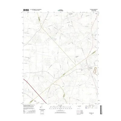
2016 Map of Fountain
USGS Topo · Published 2016About this map
Fountain anchors the southeastern corner of this North Carolina landscape, where the agricultural plains of Pitt and Edgecombe counties converge. The terrain is defined by an intricate network of slow-moving water, including Little Contentnea Creek and the marshy expanses of The Pocosin and Whiteoak Swamp. These wetlands dictate the rural road patterns, which wind around landmarks such as Strickland Pond and various family-named farm roads. Northward, the village of Macclesfield and the community of Turnage mark the higher ground between the tributaries of Otter Creek and Bynums Mill Run. The map preserves the placement of local landmarks like Memorial Cemetery, providing a detailed look at the 2016 layout of these historic farming communities and their relationship to the swampy lowlands that have long shaped the region's development.
Find a feature on this map
76 named features on this map. Tap any name to fly to it.
Don’t see what you’re looking for? This feature index may not catch every label — zoom into the map to look around manually.
Map Details
Editions of this 2016 Fountain Map
This is the sole edition of this map. No revisions or reprints were ever made.
Other maps of this area

1902 · Rocky Mount
USGS Topo · 1:62,500

1902 · Tarboro
USGS Topo · 1:62,500

1903 · Tarboro
USGS Topo · 1:62,500

1904 · Falkland
USGS Topo · 1:62,500

1904 · Rocky Mount
USGS Topo · 1:62,500

1904 · Wilson
USGS Topo · 1:62,500

1953 · Rocky Mount
USGS Topo · 1:250,000

1954 · Rocky Mount
USGS Topo · 1:250,000
1977 · Elm City
USGS Topo · 1:24,000
1978 · Stantonsburg
USGS Topo · 1:24,000