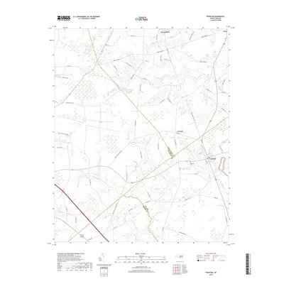
2019 Map of Fountain
USGS Topo · Published 2019About this map
Fountain serves as the primary hub of this eastern North Carolina landscape, situated at the confluence of several rural thoroughfares and drainage ways. The surrounding terrain is defined by a complex network of waterways, including the slow-moving Little Contentnea Cr and the marshy expanses of The Pocosin and Whiteoak Swamp. These natural features have historically dictated the placement of agricultural tracts and small settlements like Macclesfield, Turnage, and Crisp.
Find a feature on this map
75 named features on this map. Tap any name to fly to it.
Don’t see what you’re looking for? This feature index may not catch every label — zoom into the map to look around manually.
Map Details
Editions of this 2019 Fountain Map
This is the sole edition of this map. No revisions or reprints were ever made.
Other maps of this area

1902 · Rocky Mount
USGS Topo · 1:62,500

1902 · Tarboro
USGS Topo · 1:62,500

1903 · Tarboro
USGS Topo · 1:62,500

1904 · Falkland
USGS Topo · 1:62,500

1904 · Rocky Mount
USGS Topo · 1:62,500

1904 · Wilson
USGS Topo · 1:62,500

1953 · Rocky Mount
USGS Topo · 1:250,000

1954 · Rocky Mount
USGS Topo · 1:250,000
1977 · Elm City
USGS Topo · 1:24,000
1978 · Stantonsburg
USGS Topo · 1:24,000