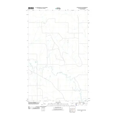
2011 Map of Four Buttes NE
USGS Topo · Published 2011About this map
The Middle Fork Poplar River meanders across this northern landscape, defining the local drainage and topography in 2011. This stretch of the river system, characterized by its winding course through the prairie, highlights the rural character of the borderlands between Montana and Saskatchewan. To the west, the presence of Silver Lake provides a distinct hydrologic landmark in an otherwise open terrain. Human activity is sparse and structured around a simple transportation grid, with thoroughfares such as French Ln and County Rd serving as the primary routes for local access. The map illustrates a quiet, wide-open geography where natural watercourses remain the dominant features of the environment.
Find a feature on this map
4 named features on this map. Tap any name to fly to it.
Don’t see what you’re looking for? This feature index may not catch every label — zoom into the map to look around manually.
Map Details
Editions of this 2011 Four Buttes NE Map
This is the sole edition of this map. No revisions or reprints were ever made.
Other maps of this area

1954 · Wolf Point
USGS Topo · 1:250,000

1958 · Wolf Point
USGS Topo · 1:250,000

1973 · Scobey
USGS Topo · 1:24,000

1973 · Scobey NW
USGS Topo · 1:24,000

1973 · Killenbeck Reservoir
USGS Topo · 1:24,000

1973 · Four Buttes NE
USGS Topo · 1:24,000

1973 · Four Buttes
USGS Topo · 1:24,000

1973 · Four Buttes NW
USGS Topo · 1:24,000

1983 · Scobey
USGS Topo · 1:100,000
2011 · Four Buttes
USGS Topo · 1:24,000