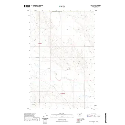
2020 Map of Four Buttes NE
USGS Topo · Published 2020About this map
Silver Lake sits at the heart of this high plains landscape along the international border between Montana and Saskatchewan. The terrain is defined by the winding drainage of the Middle Fork Poplar River and the sharp incision of Audet Coulee to the southwest. Named roads such as Tymofichuk Rd, Hagfeldt Rd, and Olson Ln suggest a history of family-held land and agricultural settlement in this northern reach of Daniels County. The presence of Coal Mine Rd indicates the area's connection to local resource extraction, while the section lines and township boundaries of t37n r46e and t37n r47e delineate the grid-based land management characteristic of this prairie region in the early twenty-first century.
Find a feature on this map
16 named features on this map. Tap any name to fly to it.
Don’t see what you’re looking for? This feature index may not catch every label — zoom into the map to look around manually.
Map Details
Editions of this 2020 Four Buttes NE Map
This is the sole edition of this map. No revisions or reprints were ever made.
Other maps of this area

1954 · Wolf Point
USGS Topo · 1:250,000

1958 · Wolf Point
USGS Topo · 1:250,000

1973 · Scobey
USGS Topo · 1:24,000

1973 · Scobey NW
USGS Topo · 1:24,000

1973 · Killenbeck Reservoir
USGS Topo · 1:24,000

1973 · Four Buttes NE
USGS Topo · 1:24,000

1973 · Four Buttes
USGS Topo · 1:24,000

1973 · Four Buttes NW
USGS Topo · 1:24,000

1983 · Scobey
USGS Topo · 1:100,000
2011 · Four Buttes
USGS Topo · 1:24,000