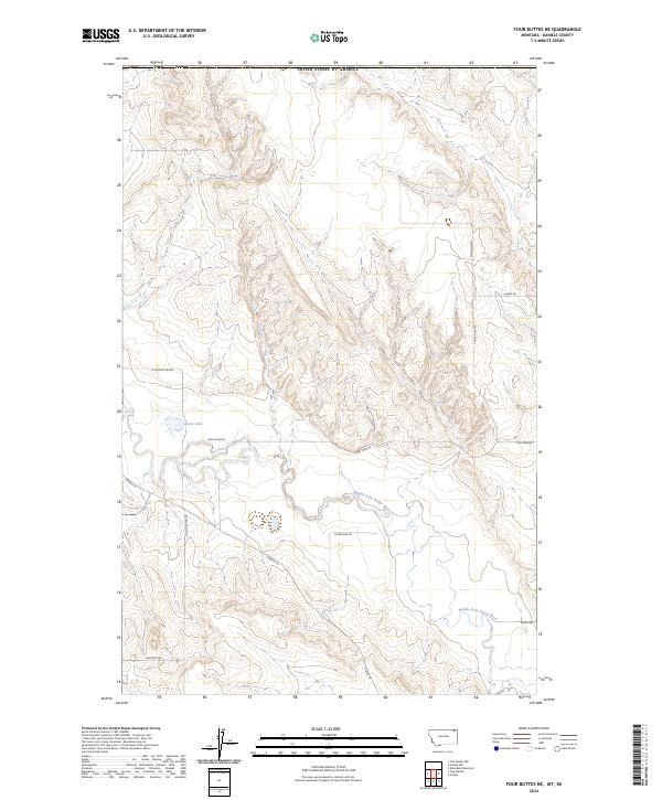
2024 Map of Four Buttes NE
USGS Topo · Published 2024About this map
Silver Lake and the winding Middle Fork Poplar River anchor this landscape in the northeastern corner of Daniels County. The terrain is characterized by the complex drainage patterns of the Missouri River basin, shaped by intermittent streams and coulees that cut through the high plains. Historical land use and family settlement patterns are evident in the naming of local thoroughfares, including Tymofichuk Rd, Hagfeldt Rd, and Fred's Rd.
Find a feature on this map
14 named features on this map. Tap any name to fly to it.
Don’t see what you’re looking for? This feature index may not catch every label — zoom into the map to look around manually.
Map Details
Editions of this 2024 Four Buttes NE Map
This is the sole edition of this map. No revisions or reprints were ever made.
Other maps of this area

1954 · Wolf Point
USGS Topo · 1:250,000

1958 · Wolf Point
USGS Topo · 1:250,000

1973 · Scobey
USGS Topo · 1:24,000

1973 · Scobey NW
USGS Topo · 1:24,000

1973 · Killenbeck Reservoir
USGS Topo · 1:24,000

1973 · Four Buttes NE
USGS Topo · 1:24,000

1973 · Four Buttes
USGS Topo · 1:24,000

1973 · Four Buttes NW
USGS Topo · 1:24,000

1983 · Scobey
USGS Topo · 1:100,000
2011 · Four Buttes
USGS Topo · 1:24,000