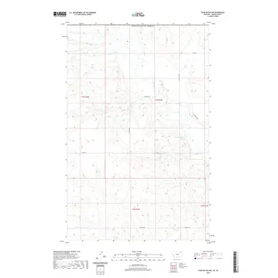
2020 Map of Four Buttes NW
USGS Topo · Published 2020About this map
Daniels County terrain along the international border is defined by the ephemeral watercourses and local ranch roads of Montana's High Plains. The landscape is carved by Coal Cr in the north and Butte Cr in the south, reflecting a drainage pattern typical of this arid region. The presence of the 37N46E27BCDC01 Spring suggests a vital water source for livestock in an area otherwise dominated by coulees and plateaus. Settlement patterns are evidenced by family-named infrastructure, including Olson Ln, Halverson Rd, and Hagfeldt Rd, which segment the land into the Public Land Survey System grids of t37n r46e and surrounding townships. This map provides a clear view of the rural road network, from N Four Buttes Rd to the quiet stretch of French Ln, as it appeared at the beginning of the 2020s.
Find a feature on this map
13 named features on this map. Tap any name to fly to it.
Don’t see what you’re looking for? This feature index may not catch every label — zoom into the map to look around manually.
Map Details
Editions of this 2020 Four Buttes NW Map
This is the sole edition of this map. No revisions or reprints were ever made.
Other maps of this area

1954 · Wolf Point
USGS Topo · 1:250,000

1958 · Wolf Point
USGS Topo · 1:250,000

1973 · Peerless
USGS Topo · 1:24,000

1973 · Carbert
USGS Topo · 1:24,000

1973 · Killenbeck Reservoir
USGS Topo · 1:24,000

1973 · Four Buttes NE
USGS Topo · 1:24,000

1973 · Four Buttes
USGS Topo · 1:24,000

1973 · Four Buttes NW
USGS Topo · 1:24,000

1983 · Scobey
USGS Topo · 1:100,000
2011 · Four Buttes
USGS Topo · 1:24,000