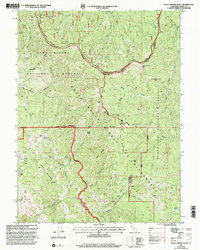
1997 Map of Four Corners Rock
USGS Topo · Published 2001About this map
Bolly Ridge and Jones Ridge dominate this high-elevation landscape where the Six Rivers National Forest meets the Mendocino National Forest. At the time of this late-twentieth-century revision, the area remained a strictly managed wilderness, protected as the Yolla Bolly-Middle Eel Wilderness. Within this complex terrain, isolated points of human activity are documented, including the Travis Ranch and Vann Cabin, which provide evidence of the region's ranching and seasonal history. The drainage network is clearly defined by the Mad River and the Middle Fork Eel River, while localized industrial history is noted at the Trout Creek Mine (Site) and Blue Jay Mine (Site). Landmarks such as Four Corners Rock and Big Butte serve as primary navigational points in a terrain defined by steep ridges and secluded basins like Clarks Basin.
Find a feature on this map
48 named features on this map. Tap any name to fly to it.
Don’t see what you’re looking for? This feature index may not catch every label — zoom into the map to look around manually.
Map Details
Editions of this 1997 Four Corners Rock Map
This is the sole edition of this map. No revisions or reprints were ever made.
Other maps of this area

1920 · Covelo
USGS Topo · 1:62,500

1921 · Hoaglin
USGS Topo · 1:62,500

1922 · Island Mountain
USGS Topo · 1:62,500

1926 · Covelo
USGS Topo · 1:62,500

1931 · Hoaglin
USGS Topo · 1:96,000

1935 · Hoaglin
USGS Topo · 1:125,000

1952 · Spyrock
USGS Topo · 1:62,500

1952 · Covelo
USGS Topo · 1:62,500

1953 · Blackrock Mtn
USGS Topo · 1:62,500

1954 · Blackrock Mtn
USGS Topo · 1:62,500