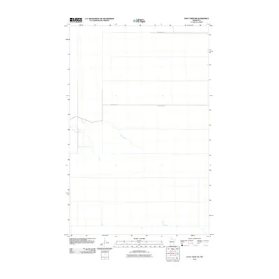
2010 Map of Four Town NW
USGS Topo · Published 2010About this map
Moose River meanders across this northern Minnesota landscape, providing the primary natural drainage for this portion of Beltrami County. This 2010 topographic record documents a largely uninhabited territory defined by its wetland hydrology and a sparse network of forest roads. Human presence is evidenced primarily by straight-line corridor developments such as Moose River Rd and Morehouse Rd, which cut through the terrain to support timber management or rural access. The map reveals the subtle elevations and drainage patterns of the North Woods before modern development altered these remote northern reaches.
Find a feature on this map
3 named features on this map. Tap any name to fly to it.
Don’t see what you’re looking for? This feature index may not catch every label — zoom into the map to look around manually.
Map Details
Editions of this 2010 Four Town NW Map
This is the sole edition of this map. No revisions or reprints were ever made.
Other maps of this area

1918 · Pencer
USGS Topo · 1:62,500

1918 · Malcolm
USGS Topo · 1:62,500

1919 · Liner
USGS Topo · 1:62,500

1954 · Roseau
USGS Topo · 1:250,000

1957 · Roseau
USGS Topo · 1:250,000

1958 · Roseau
USGS Topo · 1:250,000

1968 · Mulligan Lake SW
USGS Topo · 1:24,000
1968 · Mulligan Lake
USGS Topo · 1:24,000
1969 · Skime
USGS Topo · 1:24,000

1973 · Gates Corner
USGS Topo · 1:24,000