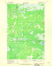
1968 Map of Mulligan Lake
USGS Topo · Published 1971About this map
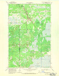
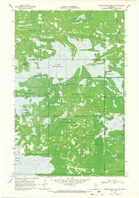
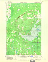
Beltrami Island State Forest defines this vast northern Minnesota landscape, where the convergence of Roseau, Beltrami, and Lake of the Woods counties creates a complex jurisdictional boundary in the late 1960s. The terrain is a mosaic of wetlands and forest, dominated by the Red Lake Indian Reservation and the Red Lake State Wildlife Management Area. Human activity is largely confined to a network of unimproved Jeep Trails and standard Trails that weave through the marshy lowlands surrounding Mulligan Lake and the meandering Roseau River. A small Gravel Pit near the reservation boundary and the headwaters of Hansen Creek indicate localized extraction in an otherwise largely undeveloped wilderness preserved for conservation and tribal use.
Find a feature on this map
13 named features on this map. Tap any name to fly to it.
Don’t see what you’re looking for? This feature index may not catch every label — zoom into the map to look around manually.
Map Details
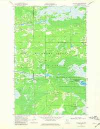
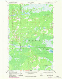
Editions of this 1968 Mulligan Lake Map
3 editions found
Other maps of this area

1918 · Winterroad
USGS Topo · 1:62,500

1918 · F
USGS Topo · 1:62,500

1918 · Malcolm
USGS Topo · 1:62,500

1954 · Roseau
USGS Topo · 1:250,000

1957 · Roseau
USGS Topo · 1:250,000

1958 · Roseau
USGS Topo · 1:250,000
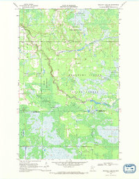
1968 · Mulligan Lake SW
USGS Topo · 1:24,000
1968 · Mulligan Lake NE
USGS Topo · 1:24,000
1968 · Winter Road Lake NW
USGS Topo · 1:24,000
1968 · Mulligan Lake NW
USGS Topo · 1:24,000