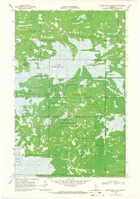
1968 Map of Winter Road Lake NW
USGS Topo · Published 1971About this map
Beltrami Island State Forest dominates this landscape in northern Minnesota, where the boundary between Roseau and Lake of the Woods counties meets the northern reaches of the Red Lake Indian Reservation. The terrain is defined by an intricate network of wetlands and drainage efforts, most notably the Judicial Ditch No 62. This 1960s era survey captures a region managed for timber and conservation, where human presence is marked by resource extraction and seasonal access rather than permanent settlements. Transport through the dense forest and marshland is limited to the Bednar Trail and various unnamed Jeep Trails, which navigate around natural features like the Beaver Pond and the headwaters of the East Branch Warroad River. Several Gravel Pits are noted along these trails, suggesting the ongoing maintenance of the forest road system during this period.
Find a feature on this map
12 named features on this map. Tap any name to fly to it.
Don’t see what you’re looking for? This feature index may not catch every label — zoom into the map to look around manually.
Map Details
Editions of this 1968 Winter Road Lake NW Map
This is the sole edition of this map. No revisions or reprints were ever made.
Other maps of this area

1918 · Winterroad
USGS Topo · 1:62,500

1918 · Roosevelt
USGS Topo · 1:62,500

1918 · Warroad
USGS Topo · 1:62,500

1943 · Roosevelt
USGS Topo · 1:62,500

1943 · Warroad
USGS Topo · 1:62,500

1954 · Roseau
USGS Topo · 1:250,000

1957 · Roseau
USGS Topo · 1:250,000

1958 · Roseau
USGS Topo · 1:250,000
1967 · Roosevelt
USGS Topo · 1:24,000
1967 · Warroad SE
USGS Topo · 1:24,000