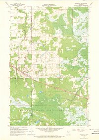
1967 Map of Roosevelt
USGS Topo · Published 1969About this map
Roosevelt serves as the primary settlement on this late 1960s survey, straddling the boundary between Roseau and Lake of the Woods counties. The village is tightly tied to the Canadian National railroad, which cuts a straight path through the northern woods and marshlands. To the north, the landscape includes a portion of the Red Lake Indian Reservation, while the southern reaches of the map are dominated by the extensive Beltrami Island State Forest. This is a landscape defined by water and timber management, where drainage is provided by Willow Creek and Tomato Creek. The presence of the Krull Trail near Norquist Lake suggests a backcountry network utilized for logging or forest access, contrasted with the industrial activity found at various Gravel Pits located along the rail line and main roadways.
Find a feature on this map
12 named features on this map. Tap any name to fly to it.
Don’t see what you’re looking for? This feature index may not catch every label — zoom into the map to look around manually.
Map Details
Editions of this 1967 Roosevelt Map
2 editions found
Other maps of this area

1918 · Winterroad
USGS Topo · 1:62,500

1918 · Roosevelt
USGS Topo · 1:62,500

1918 · Williams
USGS Topo · 1:62,500

1919 · Peppermint Creek
USGS Topo · 1:62,500

1943 · Peppermint Creek
USGS Topo · 1:62,500

1943 · Roosevelt
USGS Topo · 1:62,500

1954 · Roseau
USGS Topo · 1:250,000

1957 · Roseau
USGS Topo · 1:250,000

1958 · Roseau
USGS Topo · 1:250,000

1967 · Williams
USGS Topo · 1:24,000