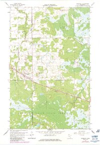
1967 Map of Roosevelt
USGS Topo · Published 1984About this map
The borderlands of Roseau Co and Lake of the Woods Co converge at the small settlement of Roosevelt, a community defined by its position along the Canadian National railroad. This northern Minnesota landscape transitions from the managed timberlands of the Beltrami Island State Forest in the south to the northwestern reach of the Red Lake Indian Reservation. The terrain is characterized by a complex network of wetlands and small waterways, including the winding Willow Creek and Tomato Creek. Photorevisions added in the early 1980s highlight subtle changes to the landscape since the original 1967 survey, such as developments near the Radio Tower and various gravel pits that suggest local industry. To the south, the Krull Trail skirts the edge of Norquist Lake, providing a trace of the era's recreational or resource access routes through the dense forest and marsh.
Find a feature on this map
14 named features on this map. Tap any name to fly to it.
Don’t see what you’re looking for? This feature index may not catch every label — zoom into the map to look around manually.
Map Details
Editions of this 1967 Roosevelt Map
2 editions found
Other maps of this area

1918 · Winterroad
USGS Topo · 1:62,500

1918 · Roosevelt
USGS Topo · 1:62,500

1918 · Williams
USGS Topo · 1:62,500

1919 · Peppermint Creek
USGS Topo · 1:62,500

1943 · Peppermint Creek
USGS Topo · 1:62,500

1943 · Roosevelt
USGS Topo · 1:62,500

1954 · Roseau
USGS Topo · 1:250,000

1957 · Roseau
USGS Topo · 1:250,000

1958 · Roseau
USGS Topo · 1:250,000

1967 · Williams
USGS Topo · 1:24,000