1919 Map of Peppermint Creek
USGS Topo · Published 1919About this map
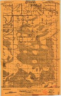
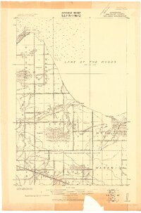
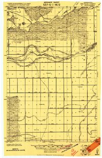
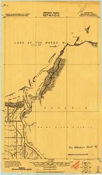
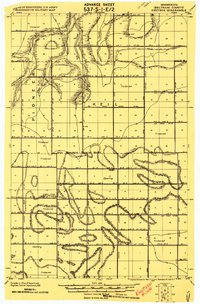
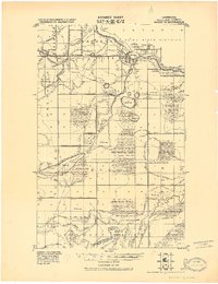
Graceton sits as the primary settlement in this northern landscape, situated along the Canadian Northern railroad just south of the border. This 1919 progressive military map provides a detailed look at the complex hydrological management of Beltrami County, specifically illustrating the extensive network of drainage projects like Main Judicial Ditch No 23 and Judicial Ditch No 17. These artificial waterways cut through a terrain defined by alternating stretches of timbered land and swamp, with limits based on a 1908 drainage survey of Ceded Chippewa Lands.
Find a feature on this map
30 named features on this map. Tap any name to fly to it.
Don’t see what you’re looking for? This feature index may not catch every label — zoom into the map to look around manually.
Map Details
Editions of this 1919 Peppermint Creek Map
This is the sole edition of this map. No revisions or reprints were ever made.
Other maps of this area

1918 · Winterroad
USGS Topo · 1:62,500

1918 · Roosevelt
USGS Topo · 1:62,500

1918 · F
USGS Topo · 1:62,500
1918 · Williams
USGS Topo · 1:62,500
1919 · G
USGS Topo · 1:62,500
1919 · Canada
USGS Topo · 1:62,500
1919 · Knutson
USGS Topo · 1:62,500
1921 · Baudette
USGS Topo · 1:62,500
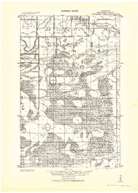
1943 · Peppermint Creek
USGS Topo · 1:62,500

1943 · Roosevelt
USGS Topo · 1:62,500