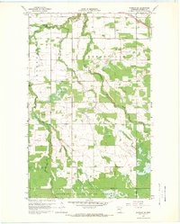
1967 Map of Warroad SE
USGS Topo · Published 1969About this map
The West Branch Warroad River and East Branch Warroad River converge in the northern reaches of this township, defining a landscape shaped by glacial drainage and timber. The township of Moranville dominates the central portion of the map, where a local Townhall and the Mennonite Ch serve as early focal points for the rural community. Moving south, the terrain transitions into the protected wilderness of the Beltrami Island State Forest, where the remote Tangnes Trail cuts through the woods. The northern border is marked by industrial activity, including several Gravel Pits and the heavy transport corridor of the Canadian National railroad. Water management is evident through the engineered Ditch No 25, while smaller tributaries like Bulldog Run and Clausner Creek flow through the increasingly dense vegetation of the state forest.
Find a feature on this map
13 named features on this map. Tap any name to fly to it.
Don’t see what you’re looking for? This feature index may not catch every label — zoom into the map to look around manually.
Map Details
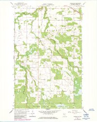
Editions of this 1967 Warroad SE Map
2 editions found
Other maps of this area

1918 · Winterroad
USGS Topo · 1:62,500

1918 · Roosevelt
USGS Topo · 1:62,500

1918 · Warroad
USGS Topo · 1:62,500

1943 · Roosevelt
USGS Topo · 1:62,500

1943 · Warroad
USGS Topo · 1:62,500

1954 · Roseau
USGS Topo · 1:250,000

1957 · Roseau
USGS Topo · 1:250,000

1958 · Roseau
USGS Topo · 1:250,000

1967 · Roosevelt NW
USGS Topo · 1:24,000
1967 · Warroad NW
USGS Topo · 1:24,000