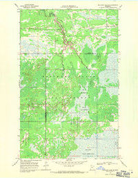
1968 Map of Mulligan Lake NE
USGS Topo · Published 1971About this map
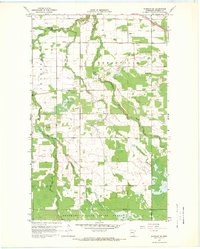
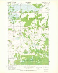
Beltrami Island State Forest dominates this northern Minnesota landscape, where the headwaters of the Warroad River wind through a dense mosaic of wetlands and timber. Mapped in the late 1960s, the terrain is defined by its isolation and the transition into the Red Lake Indian Reservation along the southern boundary. Human presence is sparse, marked primarily by utilitarian features like several Gravel Pits and the Lookout Tower BM 1208, which provided a critical vantage point for forest fire management. The Bednar Trail and other unnamed tracks offer the only passage through the low-lying boggy areas between Roseau and Lake of the Woods counties. For genealogists and local historians, the Pine Ridge Cem in the northeast corner serves as a significant site of remembrance within this largely undeveloped wilderness.
Find a feature on this map
11 named features on this map. Tap any name to fly to it.
Don’t see what you’re looking for? This feature index may not catch every label — zoom into the map to look around manually.
Map Details
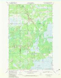
Editions of this 1968 Mulligan Lake NE Map
2 editions found
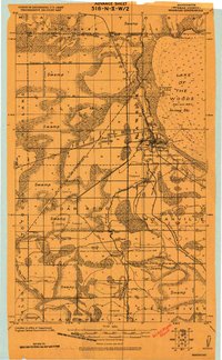
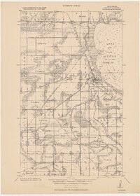
Other maps of this area

1918 · Winterroad
USGS Topo · 1:62,500

1918 · Roosevelt
USGS Topo · 1:62,500
1918 · Warroad
USGS Topo · 1:62,500

1943 · Roosevelt
USGS Topo · 1:62,500
1943 · Warroad
USGS Topo · 1:62,500

1954 · Roseau
USGS Topo · 1:250,000

1957 · Roseau
USGS Topo · 1:250,000

1958 · Roseau
USGS Topo · 1:250,000
1967 · Warroad SE
USGS Topo · 1:24,000
1967 · Warroad SW
USGS Topo · 1:24,000