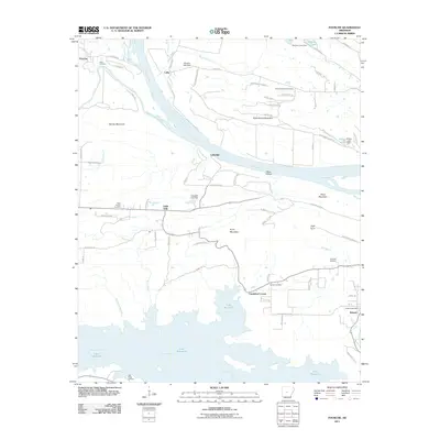
2011 Map of Fourche
USGS Topo · Published 2011About this map
Arkansas River and Fourche LaFave River confluences dominate this section of the river valley as it looked in the early 21st century. The landscape is a mix of agricultural bottoms near Lollie and the rising elevations of Kenney Mountain and Easterwood Mountain. Several small communities and named crossroads anchor the rural road network, including the historic enclave of Little Italy and the settlement at Lundsford Corner. To the south, the massive expanse of Lake Maumelle is a prominent geographic feature, fed by the Maumelle River and Stillhouse Branch. Genealogists will find numerous family-associated burial grounds throughout the area, such as Faisst Cemetery and Rainey Cemetery, which provide clues to the generational settlement of these riverine uplands. The presence of the Roland Post Office and Jolly Roger Landing on Lake Maumelle further highlights the blend of administrative centers and modern recreational spaces that characterize this region.
Find a feature on this map
84 named features on this map. Tap any name to fly to it.
Don’t see what you’re looking for? This feature index may not catch every label — zoom into the map to look around manually.
Map Details
Editions of this 2011 Fourche Map
This is the sole edition of this map. No revisions or reprints were ever made.
Other maps of this area

1890 · Benton
USGS Topo · 1:125,000

1891 · Little Rock
USGS Topo · 1:125,000

1892 · Morrillton
USGS Topo · 1:125,000

1893 · Little Rock
USGS Topo · 1:125,000

1894 · Morrillton
USGS Topo · 1:125,000

1894 · Benton
USGS Topo · 1:125,000

1943 · Pinnacle Mtn
USGS Topo · 1:31,680

1953 · Mayflower
USGS Topo · 1:24,000
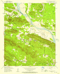
1954 · Pinnacle Mountain
USGS Topo · 1:24,000

1955 · Little Rock
USGS Topo · 1:250,000