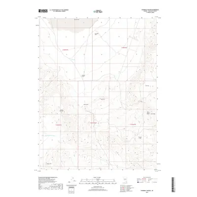
2018 Map of Fourmile Canyon
USGS Topo · Published 2018About this map
Fourmile Flat and the Salt Wells Basin dominate the northern landscape of this Churchill County quadrangle, where the desert floor meets the rising peaks of the Sand Springs Range. This 2018 USGS survey details a network of dry washes and high-elevation features, including Diamond Field Jack Wash and the distinct formation of Aplite Ridge. The southern portion of the map is defined by the Barnett Hills and the Cocoon Mountains, areas marked by deep drainage systems like Arterial Canyon and G Z Canyon. The presence of Rock Springs provides a rare water reference in a terrain characterized by its numerous named canyons, such as Fourmile Canyon and Bills Canyon, which carve through the high desert topography.
Find a feature on this map
19 named features on this map. Tap any name to fly to it.
Don’t see what you’re looking for? This feature index may not catch every label — zoom into the map to look around manually.
Map Details
Editions of this 2018 Fourmile Canyon Map
This is the sole edition of this map. No revisions or reprints were ever made.
Other maps of this area

1908 · Carson Sink
USGS Topo · 1:250,000

1910 · Carson Sink
USGS Topo · 1:250,000

1951 · Carson Lake
USGS Topo · 1:62,500

1951 · Allen Springs
USGS Topo · 1:62,500

1957 · Reno
USGS Topo · 1:250,000

1959 · Reno
USGS Topo · 1:250,000

1960 · Reno
USGS Topo · 1:250,000

1972 · Fourmile Flat
USGS Topo · 1:24,000
1972 · Frenchman
USGS Topo · 1:24,000

1979 · Fallon
USGS Topo · 1:100,000