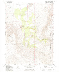
1979 Map of Fourmile Canyon
USGS Topo · Published 1980About this map
Fourmile Flat (Alkali) and the Salt Wells Basin dominate this high-desert landscape in the late 1970s, characterized by expansive alkali flats and complex ridgelines. The area is a hub of geological and industrial activity, marked by the presence of the Project Shoal Monument and the US Naval Reservation (Target Area) on its eastern edge. These features, along with specialized infrastructure like the Atomic Well and Bucky O'Neil Well (Flowing), suggest a history of government research and resource management.
Find a feature on this map
29 named features on this map. Tap any name to fly to it.
Don’t see what you’re looking for? This feature index may not catch every label — zoom into the map to look around manually.
Map Details
Editions of this 1979 Fourmile Canyon Map
This is the sole edition of this map. No revisions or reprints were ever made.
Other maps of this area

1908 · Carson Sink
USGS Topo · 1:250,000

1910 · Carson Sink
USGS Topo · 1:250,000

1951 · Carson Lake
USGS Topo · 1:62,500

1951 · Allen Springs
USGS Topo · 1:62,500

1957 · Reno
USGS Topo · 1:250,000

1959 · Reno
USGS Topo · 1:250,000

1960 · Reno
USGS Topo · 1:250,000

1972 · Fourmile Flat
USGS Topo · 1:24,000
1972 · Frenchman
USGS Topo · 1:24,000

1979 · Fallon
USGS Topo · 1:100,000