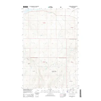
2014 Map of Fourmile Spring
USGS Topo · Published 2014About this map
Lewis & Clark National Forest encompasses the majority of this high-elevation Meagher County landscape, defined by a complex network of springs and drainage systems. This 2014 survey details a remote mountain environment where water sources like Lake Sutherlin in the northwest and Fourmile Spring serve as critical landmarks. The terrain is marked by significant clearings and high-ground features including Richardson Park, Horse Park, and the prominent Limestone Ridge to the southeast.
Find a feature on this map
29 named features on this map. Tap any name to fly to it.
Don’t see what you’re looking for? This feature index may not catch every label — zoom into the map to look around manually.
Map Details
Editions of this 2014 Fourmile Spring Map
This is the sole edition of this map. No revisions or reprints were ever made.
Other maps of this area

1886 · Little Belt Mts.
USGS Topo · 1:250,000

1894 · Little Belt Mts.
USGS Topo · 1:250,000

1897 · Little Belt Mts.
USGS Topo · 1:250,000

1898 · Little Belt Mts.
USGS Topo · 1:250,000

1902 · Little Belt Mts.
USGS Topo · 1:250,000

1948 · White Sulphur Springs
USGS Topo · 1:250,000

1958 · White Sulphur Springs
USGS Topo · 1:250,000

1961 · White Sulphur Springs
USGS Topo · 1:250,000

1965 · White Sulphur Springs
USGS Topo · 1:250,000
1971 · Charcoal Gulch
USGS Topo · 1:24,000