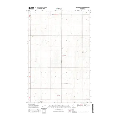
2014 Map of Fourteenmile Coulee NW
USGS Topo · Published 2014About this map
East Fork Black Coulee and Faulkners Coulee wind through this section of Hill County, Montana, carving drainage patterns into the high plains landscape. The area is defined by a rigid section-line grid of rural roads, including Road 40 S, Road 90 S, and Road 100 S. These thoroughfares support the agricultural economy of the Big Sandy and Hingham vicinity, where large-scale dryland farming is the primary use of the terrain.
Find a feature on this map
15 named features on this map. Tap any name to fly to it.
Don’t see what you’re looking for? This feature index may not catch every label — zoom into the map to look around manually.
Map Details
Editions of this 2014 Fourteenmile Coulee NW Map
This is the sole edition of this map. No revisions or reprints were ever made.
Other maps of this area

1919 · Big Sandy
USGS Topo · 1:125,000

1919 · Alma
USGS Topo · 1:125,000

1920 · Gildford
USGS Topo · 1:125,000

1943 · Gildford
USGS Topo · 1:125,000

1954 · Shelby
USGS Topo · 1:250,000

1958 · Shelby
USGS Topo · 1:250,000

1969 · Fourteenmile Coulee SW
USGS Topo · 1:24,000

1969 · Hingham
USGS Topo · 1:24,000

1969 · Fourteenmile Coulee NW
USGS Topo · 1:24,000
1969 · Fourteenmile Coulee SE
USGS Topo · 1:24,000